This story could be summed up quite simply: a man named Robert Harper had a ferry. That’s it, the end, thank you for reading.
That was only the beginning for a sleepy town at the easternmost point of what is now West Virginia. From the top of the main railroad, you’re looking at the Shenandoah River to the south, the Potomac River to the north, West Virginia to the west, Maryland to the east, and Virginia to the south. There are 4 states out West that can brag about their convergence on one spot, being able to stand in them all at once. Whatever. Do they have two rivers at that same spot? A small historical town? The Appalachian Trail running right through it? The Lewis & Clark National Historical Trail? Oh, and there are mountains too? Yeah, I didn’t think so. Is this spot unique? Yeah, you could say that.
In 1763, a man named Robert Harper had a 125-acre parcel of land granted to him where he had a ferry that crossed the Potomac River. At this spot a town was established within the Virginia Assembly, and they called it “Shenandoah Falls at Harper’s Ferry”, later shortened to “Harper’s Ferry”, and is currently referred to as “Harpers Ferry”. J and I arrived late to our hotel and traveled through Virginia (for all of 60 seconds) to Harpers Ferry, this spot between the mountains. It was too late to see any of this at the time, but an early April start would awaken us to a beautiful place with a conflicted past.
We parked and took the shuttle to the town, passing through the mountains and railroad trusses as we went. The shuttle set us down near the point and because the town is a national landmark (as in, the whole town), we expected there to be more of a crowd. But, J and I always seem to find the right time and place where we don’t have to fight with the multitudes. Maybe being there in April helped, as not many people want to come to a higher elevation in a colder month hoping to catch a heat wave. It’s your loss, not ours. We ventured onward.
Before us was the preserved engine house. A man started a raid at the center of town against the Commonwealth of Virginia from this spot, October 1859. U.S. Army Lt. Col. Robert E. Lee and his aide, J.E.B. Stuart (maybe you’ve heard of them) were called in to expel the rebellion. They stormed the engine house and captured John Brown and most of his gang. Brown was tried for treason against the State of Virginia and hung to death. This event is significant for events that would happen just a few short years after.

It should be noted that this is the third location of the Engine House, moved from its original location to Chicago, then to its current location not far from the original spot.
As we pushed along onto the railroad tracks and up the hill, we have a beautiful view of Maryland Heights. As we look to the east across the Shenandoah River, what’s left of the railroad bridge is a reminder of the soiled past of the town. As we would see with many structures, the remnants of the bridge remain as they were, never to be rebuilt, missing windows and rooftops, just shells of what they once were. Up and onto the walkway on the bridge into Maryland we find a sign under the bridge. A black arrow with text in white tells us that, “You are here” on the Appalachian Trail, almost at the halfway point. If we decided to turn right, we could head to Maine, where a quick 1,165 mile hike would take us to the north end of the trail. Turn left, it’s a short 1,013 miles to the other end, in Georgia. Interesting. Halfway between the North and the South…as the citizens of Harper’s Ferry would find themselves in the middle of this war with the town changing hands 8 times. Because of its strategic location, it was an important point where one could more easily resupply their troops. With the constant back and forth, it would be difficult to realize what side your town fell in if it weren’t for the constant changing of flags above the buildings in the town. By 1863, Harpers Ferry, along with other portions of northwestern Virginia decided they had enough of the Confederacy and said, “peace, we’re out”, making West Virginia the 35th state to enter the Union.
From the bottom portion of the point, we worked our way through the town, walking through abandoned and gutted churches and houses sitting untouched with only the weather to subdue them further. Up the rocky mountain stairs we went, slowly toward the top, to a place called Jefferson Point. From this spot, Thomas Jefferson would say that, “The passage of the Patowmac through the Blue Ridge is perhaps one of the most stupendous scenes in Nature.” After standing in that same spot, I’m not sure how someone could look out, see everything, and not believe that God exists. His touch on this land is obvious. So, TJ, I couldn’t agree with you more.

The view from Jefferson Point. The picture doesn’t do it justice. I imagine TJ sitting here and enjoying the spot, just as we did.
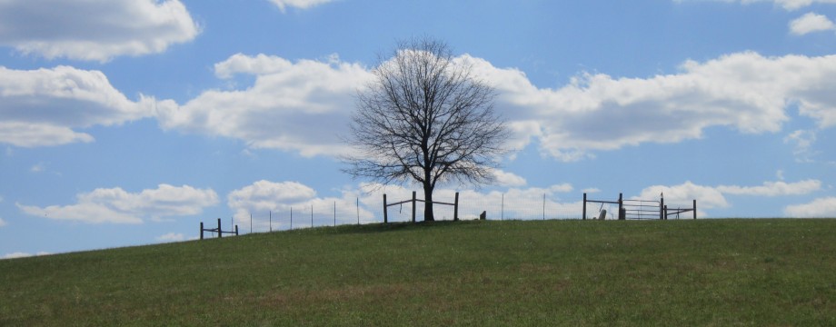
We marched up the stone steps from Jefferson Point to a local graveyard that we happened to notice (to no one’s surprise), and on the way, near a tree were a few graves from the late 1700s and early 1800s. Leaning on the back of a stone surround was the grave of Robert Harper, the namesake of the town. Not anywhere in prominence and not a large headstone per se, but it was an important find for us. The spot where he was buried offers a different perspective of the nature of the area and beside the obvious serenity, you knew why so many would come through this place and choose to rest where they do now. Others may find it odd, but J and I enjoy the peace that comes from being in such a spot. As we stood there taking our pictures, we wondered what Harper had seen in his life that led him to start his business at this juncture. There’s no way he could have foreseen what the town would experience not too long after his death.

The founder of Harpers Ferry, d. 1782.
As the day wound down, J and I were near the point, not far from the Appalachian Trail. We decided to climb up the hill and up onto the railroad tracks running through the outer edge of the old historical town. From this spot I had time to reflect on what had come through the town on these tracks and what the people here had to endure over the years. This was a town that boomed in a beautiful landscape; that was then scarred by treason; that witnessed the hanging of John Brown; that fell into Confederate hands one day, and into Union control the next; that ultimately became its own state halfway through the Civil War. This place is a living museum, in some ways it’s just as it was 150 years ago. Thankfully in others, it’s very different. The combination of landscape and history here are like no other. And, just like every other day before it, the sun would come up again tomorrow. If there’s more history that you want, go find it for yourself. I’ll bet you find it fascinating.
D

Imagine all that has come this way…we certainly did.

Well done. makes me want to visit. My hubby was taping something about Robert E Lee yesterday. Would love to see for myself…